The 750th is done and dusted. GPS stuff below.
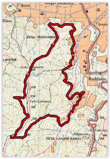
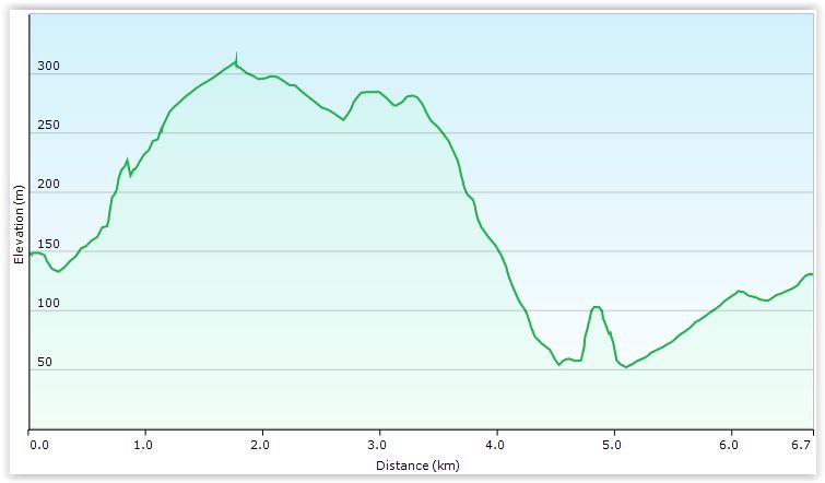
For the GPS-pedants, the Saturday trail was 6.7 kms and ranged from 52m to 310m elevation.
The GPX file is here. It can be loaded with any of the usual GPS software applicatins and Google Earth.
{google_docs}http://dilihash.wombathole.com/images/750_Run_RegForm.pdf|width:750|height:1000|link:yes|link_label:Download PDF{/google_docs}